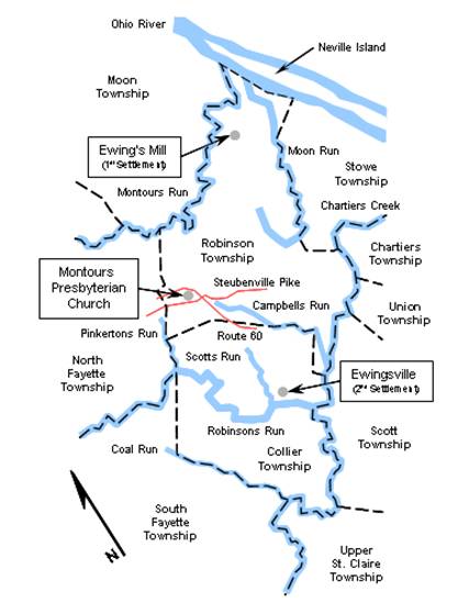
Robinson, Collier
and Surrounding Townships
in 1876
LEGEND:
Dotted Line - Township Boundary
Solid, Blue Line - River
Red Line - Current-day Roads
[Current-day Route 60, shown on the map, lies
along the path of an old, un-named country road.]
[Ewing's Mill and Ewingsville
were, respectively, the
first and second settlement sites of Squire James Ewing.]